Land Mappings
Overview
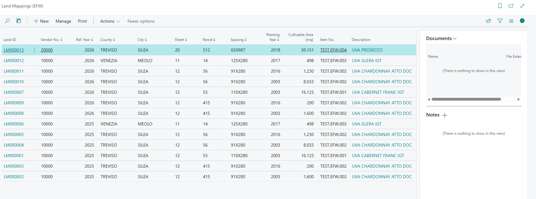
Land Mappings represent the cadastral and agricultural data for vendor-owned lands. Each land mapping record associates a vendor with a specific parcel of land, its cultivable area, the crop (item) grown, and the expected yield percentage. This data is the foundation for calculating delivery order quantities.
Fields
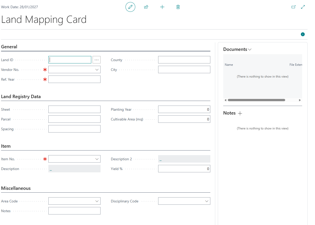
General Section
| Field | Description |
|---|---|
| Land ID | Specifies the unique identifier for the land mapping record. Assigned automatically from the number series. |
| Vendor No. | Specifies the vendor (grower or supplier) who owns or operates this land parcel. |
| Ref. Year | Specifies the reference year for this land mapping. Land mappings are tracked annually and can be copied from year to year. |
| County | Specifies the county or province where the land parcel is located. |
| City | Specifies the city or municipality where the land parcel is located. |
Land Registry Data
| Field | Description |
|---|---|
| Sheet | Specifies the cadastral sheet number from the land registry where this parcel is registered. |
| Parcel | Specifies the cadastral parcel number that identifies this specific plot within the sheet. |
| Spacing | Specifies the planting spacing or subdivision identifier within the parcel. |
| Planting Year | Specifies the year when the crops or plants were originally planted on this land parcel. |
| Cultivable Area (mq) | Specifies the total cultivable surface area of the land parcel, measured in square meters. |
Item Section
| Field | Description |
|---|---|
| Item No. | Specifies the item (product) that is cultivated or harvested from this land parcel. |
| Description | Specifies the description of the item cultivated on this land parcel. |
| Description 2 | Specifies an additional description for the item cultivated on this land parcel. |
| Yield % | Specifies the expected yield percentage for this land parcel, representing the ratio of usable product to total harvest. |
Miscellaneous
| Field | Description |
|---|---|
| Area Code | Specifies the geographic area code that groups this land mapping for reporting and delivery order creation. |
| Notes | Specifies any additional notes or remarks about this land mapping record. |
| Disciplinary Code | Specifies the production disciplinary assigned to this land parcel, defining the farming rules and yield limits that apply. |
Functions
The Land Mappings list page provides three key report actions:
Print Land Mappings
Generates a printable report of land mappings grouped by vendor. Requires a Reference Year parameter. Displays cadastral data, cultivable areas, yield percentages, and item descriptions.
Copy Land Mappings
Copies land mapping records from one reference year to another. Use this at the beginning of each harvest season to carry forward land configurations.
Parameters:
- From Year: Source reference year
- To Year: Target reference year
Behavior:
- If mappings already exist for the target year, the system asks whether to delete them first
- New records are created with new Land IDs (auto-generated)
- Vendor filter from the list page is applied
Create Delivery Orders
Creates purchase orders (or blanket orders) from land mappings. This is the primary workflow action.
Auto-Fill Behavior
When creating a new land mapping from a vendor-filtered view (e.g., opened from the Vendor Card), the Vendor No. is automatically populated from the filter.
Document Attachments
Land Mapping records support standard Business Central document attachments via the factbox panel. Attachments are linked to the specific land mapping record.
Yield Calculation
The Yield % field, combined with Cultivable Area (mq), determines the quantity of product expected from this land:
Deliverable Quantity = (Cultivable Area × Yield %) / 100
This formula is used by the Create Delivery Orders function to calculate purchase line quantities.
Feedback
Was this page helpful?
Glad to hear it! Please tell us how we can improve.
Sorry to hear that. Please tell us how we can improve.